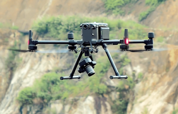
The integration of drone technology with LiDAR (Light Detection and Ranging) has revolutionized coastal management. A drone property survey, using LiDAR sensors, allows experts to gain precise topographical data from difficult-to-reach areas, including coastal regions. By harnessing the ability to survey large coastal zones quickly, drones enable better monitoring of erosion, flooding, and other environmental risks. This technology offers a valuable tool for assessing the impact of natural disasters, facilitating better coastal planning and response strategies.
How Drone Survey Service Enhances Coastal Monitoring
A drone survey service equipped with LiDAR technology significantly enhances the capabilities of traditional survey methods. Unlike conventional ground surveys, drones can easily capture high-resolution images and data from elevated positions, covering large areas in a fraction of the time. These services provide highly accurate topographic maps, which are essential for understanding the dynamic nature of coastal zones, such as shifting shorelines, beach erosion, and tidal changes. With real-time data collection, drone surveys also allow coastal engineers to make rapid assessments and decisions in areas impacted by rising sea levels or storms.
Advantages of Using Drone Property Survey for Erosion Monitoring
Erosion is one of the most pressing environmental issues affecting coastlines around the world. Traditional monitoring methods, like manual inspections or satellite imagery, often fall short in terms of accuracy and efficiency. Drone property survey, however, offers a much more effective approach. The high-resolution LiDAR sensors mounted on drones can generate precise 3D models of coastal areas, identifying small changes in elevation that might indicate the onset of erosion. These detailed maps are invaluable for detecting early signs of erosion and for tracking its progression over time, allowing for more proactive management.
Assessing Flood Risks with Drone Survey Service
Flooding poses a significant threat to coastal communities, particularly with the increasing frequency of extreme weather events. Drone services equipped with LiDAR and other sensors can provide detailed flood risk assessments by capturing data on both the topography and hydrology of the area. Drones can identify flood-prone zones, monitor the behavior of rivers and streams, and help map out flood pathways. This data is essential for urban planners and emergency response teams to develop effective flood mitigation strategies, from building stronger defenses to creating early warning systems.
The Role of Drone LiDAR in Environmental Conservation and Restoration
Beyond monitoring erosion and flood risks, drone lidar services plays a crucial role in environmental conservation and restoration projects. For example, in coastal management, the technology can be used to map out wetlands, dunes, and other critical habitats. This allows conservationists to track changes in these ecosystems over time, ensuring that restoration efforts are both effective and efficient. Additionally, drone surveys provide insights into vegetation growth, water flow patterns, and the overall health of coastal ecosystems, all of which are key to preserving biodiversity and enhancing ecosystem resilience.
The Future of Drone Surveys in Coastal Management
As drone technology continues to evolve, the potential applications in coastal management are vast. The use of drones for property surveys will likely expand to include more sophisticated sensors, such as thermal and multispectral imaging, to detect hidden environmental changes. Furthermore, the integration of AI and machine learning with drone lidar survey will improve data analysis, making it easier to predict trends in erosion, flooding, and other risks. The ability to continuously monitor coastal zones with drones promises to revolutionize how coastal communities and governments address environmental challenges.
Conclusion
The adoption of drone property survey services, particularly those leveraging LiDAR technology, has proven invaluable for monitoring coastal erosion, flood risks, and other environmental concerns. As the technology continues to advance, it will further enhance our ability to protect vulnerable coastal areas and respond to natural disasters. For more information on how drone LiDAR can benefit your coastal management projects, visit highexposure.com.au for a comprehensive range of drone survey services.

